Contact us at
info@fpwnr.org
Friends of Portbury Wharf Nature Reserve
Isnt this sunny weather lovely? Well, our early butterflies certainly think so. Walking into town this morning I have spotted three varieties already! First to show is nearly always the brimstone, and that was what I saw first - three of them! Then along came a peacock and last to show itself, on the Spanish Steps, was a red admiral. You can find lots of information on what to look out here butterfly-conservation.org/news-and-blog/species-to-spot-in-march.
butterfly-conservation.org
March 3rd is World Wildlife Day and to mark the occasion we've put together some information about the butterfly and moth species you might see if you venture out this weekend. Brimstone For many, the...
The female Black Redstart is still showing well next to Portishead Marina. It is the size of a Robin and can be easily missed. There are fewer than 100 breeding pairs in the UK, putting it on the Red List of Birds of Conservation Concern. It's also listed as a Schedule 1 species on The Wildlife and Countryside Act.
We have a new Dog Ranger of the Month! Each month one of our Dog Rangers features on our posters that are posted around the Marina and the Reserve. If your canine companion would like to become a Dog Ranger just visit our notice boards and scan the QR code on the poster!
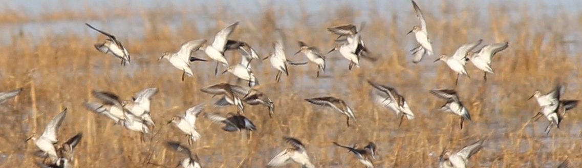
Thank you to everyone who came along to the World Wetlands Day walk on Sunday 1 February. We managed to dodge the showers and most importantly spotted 38 species! See the full list below . . . ![]()
![]() Canada Goose
Canada Goose![]() Little Grebe
Little Grebe![]() Herring gull
Herring gull![]() Blackbird
Blackbird![]() Shelduck
Shelduck![]() Peregrine
Peregrine![]() Wood pigeon
Wood pigeon![]() Robin
Robin![]() Wigeon
Wigeon![]() Moorhen
Moorhen![]() Magpie
Magpie![]() Black redstart
Black redstart![]() Gadwall
Gadwall![]() Oystercatcher
Oystercatcher![]() Crow
Crow![]() Dunnock
Dunnock![]() Teal
Teal![]() Lapwing
Lapwing![]() Blue tit
Blue tit![]() House sparrow
House sparrow![]() Mallard
Mallard![]() Curlew
Curlew![]() Great tit
Great tit![]() Pied wagtail
Pied wagtail![]() Shoveler
Shoveler![]() Redshank
Redshank![]() Long-tailed tit
Long-tailed tit![]() Bullfinch
Bullfinch![]() Tufted duck
Tufted duck![]() Black-headed gull
Black-headed gull![]() Starling
Starling![]() Chaffinch
Chaffinch![]() Pheasant
Pheasant![]() Mediterranean gull
Mediterranean gull![]() Coot
Coot![]() Buzzard
Buzzard![]() Water Rail (heard only)
Water Rail (heard only)![]() Lesser black-backed gull
Lesser black-backed gull
Want to know more about the Wetland on your doorstep? Join the Friends of Portbury Wharf Nature Reserve for a guided walk along the marina, the salt marsh and into the hides. ![]()
![]() There will be knowledgeable guides in the hides to support your bird spotting and lend you the use of binoculars and scopes to see our winter birds up close 👀
There will be knowledgeable guides in the hides to support your bird spotting and lend you the use of binoculars and scopes to see our winter birds up close 👀![]()
![]() DM if you have any questions! 🐦⬛
DM if you have any questions! 🐦⬛![]()
![]() #guidedwalk #britishbirds #birdsuk
#guidedwalk #britishbirds #birdsuk
However quietly you try to open up the shutters in the hides there is always a discernible CLICK. ![]()
![]() I thought I had got away with it but, even though this roe deer was looking the other way, see how his ears are swivelled backwards picking up the metallic sound of the latch engaging. He bounded off soon after taking his two friends with him!
I thought I had got away with it but, even though this roe deer was looking the other way, see how his ears are swivelled backwards picking up the metallic sound of the latch engaging. He bounded off soon after taking his two friends with him!
World Wetlands Day is in February so we are celebrating our very own wetland at Portbury Wharf.![]()
![]() On Sunday 1st February there will be a free guided walk starting at 10.00 am from the sculpture by the Marina Lock Gates.
On Sunday 1st February there will be a free guided walk starting at 10.00 am from the sculpture by the Marina Lock Gates.![]()
![]() If you want to know why wetlands are so vital, look out for the 12 special wetlands squares on the info boards across the nature reserve. We aim to put these up tomorrow and they will stay in place for a couple of weeks.
If you want to know why wetlands are so vital, look out for the 12 special wetlands squares on the info boards across the nature reserve. We aim to put these up tomorrow and they will stay in place for a couple of weeks.
And as luck would have it a Curlew wandered past the back of the groynes where we were watching the young redstart!
Map of Portbury Wharf Nature Reserve
Home > Nature Reserve > Map of Portbury Wharf Nature Reserve
Alongside the maps are our monthly Spotting Cards to help you identify wildlife as you walk around the reserve.
The map is A3 folding to A6 which fits snugly in a pocket. On the reverse side there are some suggested walks and information on what you might see.
The map is free but if you would like to contribute to the printing costs please click on DONATE.
The SEASONAL TRACK may be temporarily closed if it becomes too muddy.
For additional information on how to get to Portbury Wharf please see the visitor information page. You might also find the nature reserve page useful so you know what to expect when you arrive.
You might also be interested in our salt marsh map poster / leaflet. Our two Portishead salt marshes are also important wildlife refuges. To read more about them why not visit our salt marsh hub?