Contact us at
info@fpwnr.org
Friends of Portbury Wharf Nature Reserve
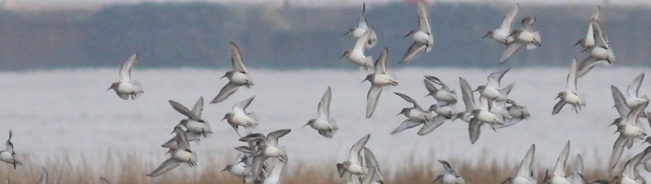

The autumn migration is getting into full swing, the days are shortening, and the infernal heat that has dominated our weather this summer has started to fade, so let’s talk about migratory birds and some of the highlights…Curlews have been away up on the moors hopefully having great success raising chicks but will be arriving back to their wintering quarters along the coast. Our numbers have dropped recently, and no one seems really sure why, but if you do see curlews in the meadows of the reserve, out on the salt marsh or along the coast, do please let us know. Our hirundines have started to leave for sunnier climes south of the Sahara, so as they head off do tip your cap to them and wish them a speedy and safe return; the swifts have left, and any swallows and martins you do see around this month are probably already on migration from more northern areas where they have spent the summer.
This interminable heat is wearying isn’t it?So I guess many of us across the UK, Canada, USA, and continental Europe will have welcomed the last few early morning mists as a hoped for sign of the changing seasons and a herald of autumn, the season of mists and mellow fruitfulness. Sorry, but this is not so much a sign of cooler temperatures to come, as a symptom of the heat we continue to endure. The wildfires which have ravaged so much of our woodland and moors has poured vast numbers of invisibly small ultra-fine particles into the air and because they are so small they can stay airborne for long long distances. Here in Portishead we have seen mists forming over our salt marshes as smoke laden air is blown south eastwards from the fires up in S, Wales and as the already saturated air cools, the gaseous water condenses onto the ultra-fine particles (also called condensation nuclei) and so they become larger and larger until they become visible when see in their hundreds of millions. And that’s where the smelly mists are coming from. The whole town has a scent of bbq, and I know its not just happening around here.So have a thought for the thousands of fire fighters across Europe and N America who are still battling fires across huge areas.One other effect of all this smoke in the air is that sunsets are absolutely glorious at the moment, not just because of all the sunny skies we have been having, but because these time particles absorb shorter wave length light which leaves the reds and oranges to dominate.Autumn will come, although I don’t think its going to be as fruitful as we would hope this year!There! I better you didn't think you would be getting a lesson in air pollution this morning did you!
Saturday's Dragonfly WalkIt was fairly cloudy and breezy as we set off from Swan Lake in the Ecology Park. Not good for dragonfly spotting, they like it calm and sunny.However, by the time we reached the newest dragonfly pond there was more sun, less wind and we got lucky. First sight was an Emperor Dragonfly, the largest of the species (see photo in previous post), flying over the meadow of wild flowers. This was swiftly followed by the small, but-oh-so elegant blue damselflies (Common blue and Blue-Tailed) flitting above the water. Broad-Bodied Chaser (pictured) and Ruddy Darter dragonflies also put in an appearance. The pond had mostly dried out but what was left was crystal clear and we could spot newt larva swimming just below the surface. Unfortunately, an out of control dog jumped in and muddied the waters, literally! The subsequent plume of sediment radiated out across the pond obliterating the underwater world.[Please keep dogs out of wildlife ponds. We like to keep our four-legged friends healthy by using flea and tick treatments. Unfortunately this leaches off our dogs into water and even minuscule quantities of these chemicals are extremely toxic to aquatic life. So as well as disturbing wildlife (and wildlife watchers) dogs can inadvertently introduce poisons into waterways.]As we walked back more Odonata, the scientific category for Dragonflies and Damselflies, were spotted by the Board Walk ponds. So next time you walk here on a warm, sunny day keep your eyes peeled for these stunning insects.
DRAGONFLY WALKSaturday 4 July - 10amDiscover the wildlife that calls Portbury Wharf Nature Reserve its home. Enjoy a guided walk from a knowledgeable volunteer. We'll be focusing on the many species, particularly dragonflies, that flourish in the wetland and how their habitats are looked after to protect them. Come along for a peaceful stroll and to learn more about our treasured local nature haven.Meet at 10am by Swan Lake in the ECOLOGY PARK – entrance by foot from Robin Place, BS20 7PX or Fennel Rd, BS20 7FB or walk from the nature reserve.What3words: //////scooter.afraid.volume
As part of the Great Big Green Week which happily coincides with World Salt Marsh Day, we have a stand in Portishead Library featuring salt marshes. This morning a volunteer from the Friends of Portbury Wharf Nature Reserve Community Group will be there to answer any questions you might have about these special habitats.
This is a great saltmarsh explainer from WWT featuring Steart Saltmarsh. . . but see if you can spot Portishead too? WWT
Something strange is happening to UK coasts
www.youtube.com
Once widespread along the UK coastline, saltmarshes have quietly di...
It's time to celebrate! It's World Salt Marsh Day tomorrow (11th June). Our nearest salt marsh is right next to the nature reserve. We are so lucky to have such an amazing habitat here. If you need convincing see the 6 myth busters from WWT . . .
During last Saturday's bird count on the reserve we were delighted to see that this Lapwing chick on the South Pool island is still alive and growing. There must now be a fair chance that it will fledge. Sadly there are very few nesting Lapwings locally these days and they usually lose their chicks to predators, so fingers crossed for this little mite. Many thanks to Enzo Della Nave for these shots of the chick digiscoped with his mobile.
Keep a look out for Painted Lady butterflies . . . they have flown here all the way from North Africa. Quite a feat for a creature so small and fragile!Find out more at butterfly-conservation.org/butterflies/painted-lady
Just a quick reminder about our free butterfly walk tomorrow morning Saturday 16 May - 10am.Discover the wildlife that calls Portbury Wharf Nature Reserve it’s home. Enjoy a guided walk from a knowledgeable volunteer, along the marina, along the salt marsh and into the nature reserve. Come along for a peaceful stroll and to learn more about our treasured local nature haven.Meet us at the red sculpture on the marina.What3words: ///yoga.valued.metals*****Another date for your diary we have a Dragonfly walk on Saturday 4 July - 10am*****
Severn Photo Posts
Coming soon, the first of our Severn Photo Posts.
Photos taken from this fixed point photographic post will record landscape changes at a targeted location, in this case, Portbury Wharf Salt Marsh. So keep an eye on this page to find out the autumn launch date.
This is an opportunity for everyone to become Citizen Scientists ie get involved in scientific research. So YOU can become a Citizen Scientist by placing your smart phone in the phone cradle, taking a photo and posting on social media.
Where will this Severn Photo Post be located?
We are putting the first permanent Severn Photo Post by Portishead Pier. Otherwise known as Fixed Point Photography it is a method of recording changes to the landscape. By taking a series of photographs over a number of years, we can collect visual evidence of erosion and deposition.
It will be pointed towards Portbury Wharf salt marsh so we can record before and after effects of tide and sea level rise. Did you know that salt marshes are one of the planet’s most important habitats, see our salt marsh hub? So it is important to know whether our salt marsh is expanding or contracting.
How will it work?
If you have a smart phone (Android or iPhone) you can use this photo post. Indeed, we need YOUR HELP to create the photo evidence of landscape changes over the coming years. It doesn’t matter whether you are just visiting for the day or regularly walk here, take a photo.
With your smart phone, you can be a citizen scientist whenever you are passing the pier.
To share your photo directly with us instead of social media please email it to saltypier@portburywharfnaturereserve.co.uk
What will happen to the photos taken from the Severn Photo Post?
Photos uploaded to social media will be viewable publicly by searching for #saltypier. We may download all photos to a central archive. We may also share photos for research purposes with universities and other organisations collecting coastal data such as CoastSnap. If we can, we will link to some of the photos on this webpage.
NB Additional cameras will have their own individual hashtag.
Why are we doing this?
It is a particularly good way for Citizen Scientists (that’s you) to take part in environmental research. As a result of global warming and climate change, sea level rise and storm events are on the increase. Therefore recording the impacts of tide and extreme weather at Portbury Wharf will provide important data. It might seem strange to take multiple photos of the same view, but even little changes can lead to big impacts over time. Having before and after photos for the next decade or so will show us the longer term trends. In addition, as the tidal range is so large here, photos taken at different stages of the tide will be markedly different.
High tide photos
Firstly, on a very high tide with a strong wind behind, the sea can overtop the sea wall. This last happened in March 2020. Significantly, the sea wall could also be breached permanently at any time potentially creating a larger salt marsh. So photos may record these events. Though, please do not use the Photo Post in storm events when this would put you at risk!
Low tide photos
Secondly, photographs taken at low tide will show changes to the mud flats. Surprisingly, mud is a great energy source for wading birds. So that’s why thousands of waders migrate here in winter to feed on our mudflats and salt marshes.
According to the WWT – The Wetland Charity:
In summary, if we create an archive of landscape photos there will be evidence of year on year changes. Not only is this useful for climate research and flood resilience it will also show whether our valuable salt marsh is expanding or contracting.
So Please Pause, Photograph and Post
So when your’e by the Pier always remember to Pause a moment, Photograph the salt marsh, Post on social media.
With thanks to Bristol Avon Catchment Partnership (BACP) who supported us with funding. In short, as a charity, we rely on grants and donations to fund our work, so thank you BACP.
Find out about Portbury Wharf Salt Marsh